Safeguarding Critical Infrastructure:
Essential Measures to Mitigate Risks and Threats
Implement redundant navigation and communication systems to ensure continued operations even during GPS disruptions.
Develop and test emergency response plans that account for potential GPS disruptions.
Employ security measures to protect against jamming, spoofing, and cyber threats. Regularly update and patch GPS equipment and systems.
Use monitoring and detection systems to promptly identify any interference or anomalies in GPS signals.
Train personnel to recognize and respond to GPS-related issues effectively.
Ensure compliance with aviation and cybersecurity regulations related to GPS use.
Understanding the GPS Attack Surface
Jamming
This involves the use of devices that emit signals at the same frequencies used by GPS satellites, effectively drowning out the real signals. This can disrupt all systems relying on GPS for navigation and timing.
Spoofing
More sophisticated than jamming, spoofing involves generating fake GPS signals that are mistaken for genuine signals. This can mislead GPS receivers about their actual location or time.
Signal Blocking
Physical obstacles like tall buildings or natural terrain features can block or reflect GPS signals, causing inaccuracies or loss of service.
Cyber Attacks
Since GPS systems are integrated with networked technologies, they are vulnerable to cyber threats that can affect data integrity and availability.
Wireless Airspace Defense:
The Key to Combating GPS Threats
AirShield GPS Canary key features:
Monitor L1/L1S GNSS Constellations
Monitor the quality of decoding L1/L1S GNSS Constellations for GPS, QZSS, GLONAS, BeiDou, Galileo, SBAS
Deviation Monitoring
Identify variations in decoded signal content such as location calculation and time shifts performed by Spoofing and Meaconing attacks.
State Changes Monitoring
Monitor for changes in signal state: Quality, loss of signal, spoofing and meaconing
Epoch-Based Events
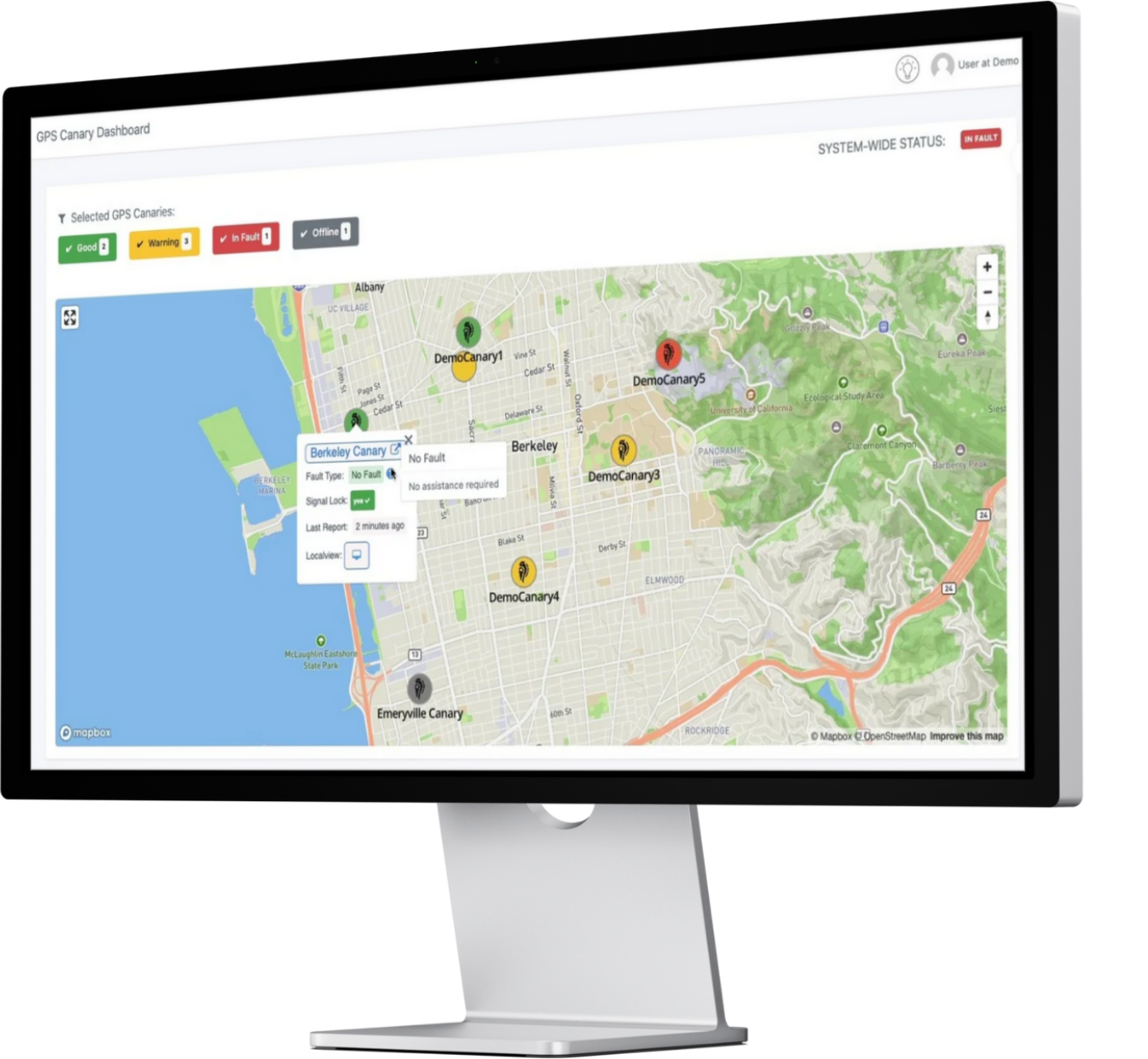
Events are epoch-based providing a history of observations across multiple deployed GPS Canaries using LOCH's cloud-based dashboard, accessible anywhere
Dashboard of Canary Health
Each GPS Canary reports to LOCH's cloud environment providing a rich history of its health
across time. Detect variations in reception quality to narrow impacted locations and time of events that impact operations.

GPS Event Logging


